Satellite-based intelligence for growing grapes
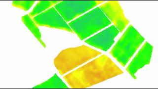
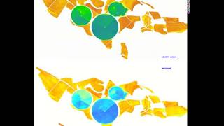
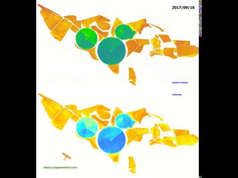
Table grape growing is an expensive business mainly due to the enormous initial establishment costs, but even the ongoing operational costs are comparatively high. It consequently makes a lot of sense to keep a close eye on how the vines are doing during the growing season and to identify problems such as water stress, pests and diseases early on so that appropriate remedial action can be taken. This infographic shows a series of maps that were generated from satellite images at 5-day interval. The chosen period is at the beginning of the growing season a few weeks after bud break. The growth vigour maps (top row) show the differential growth of shoots among blocks and even within blocks. In the moisture maps (bottom row) one can clearly see which blocks were irrigated and how some blocks dried out sooner than others (due to different terrain and soil properties). Having such maps of the entire growing season at 5-day interval is invaluable to farmers as it helps identify areas that need (more) attention. This kind of satellite-based intelligence is also ideal for designing irrigation infrastructure and for calibrating irrigation schedules. See http://bit.ly/satellitemaps for more information about the types of maps that can be produced using satellite data.